Arriving at Harvard in the autumn of 2013 with sufficient time to audit a course, and having previously used GIS technology at Oxford, I enrolled in a Digital History seminar taught by Kelly O’Neill, a historian of Imperial Russia. As recorded in my blog posts from that period, the course examined theoretical debates surrounding the digital humanities alongside practical applications of GIS, network analysis, and text analysis to historical scholarship.
For the primary course assignment, I developed an independent digital project. Drawing on maps and data regarding Afghan refugees in Iran and Pakistan during the early 1990s, and coinciding with the public release of the “Death Lists”—records of individuals executed under the People’s Democratic Party of Afghanistan regime (1978–1992)—I incorporated these digital methodologies into my ongoing research for my first book, Humanitarian Invasion: Global Development in Cold War Afghanistan.
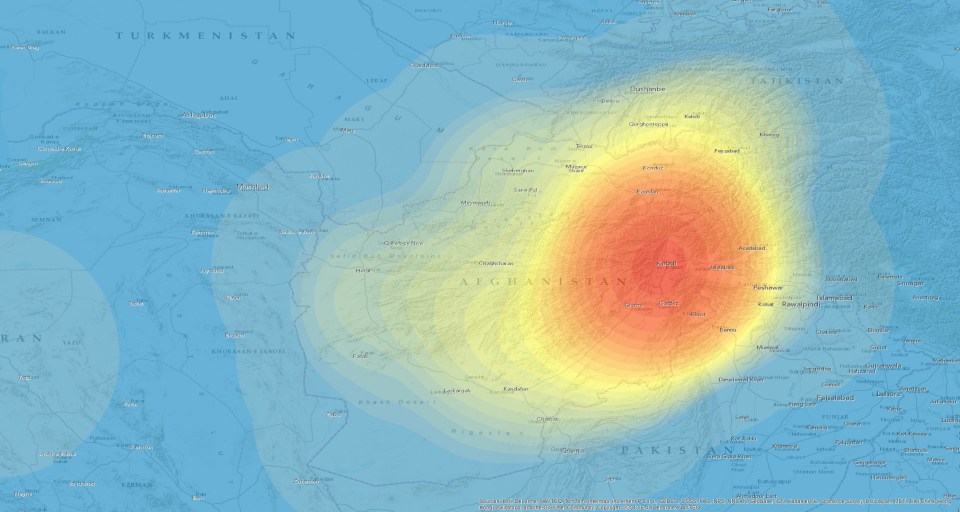
A “heat map” of state-led killing in Afghanistan during the spring and summer of 1979, one of many pieces of my new digital exhibit, “Shattering Afghanistan.”
The result was an Omeka exhibit: Shattering Afghanistan: State Destruction and Mass Murder in Central Asia. The result was an Omeka exhibit titled Shattering Afghanistan: State Destruction and Mass Murder in Central Asia. The exhibit applies GIS techniques to examine patterns of violence and forced migration in Central Asia from approximately 1978 to 1992, supporting and expanding upon the core arguments of my book, Humanitarian Invasion: Global Development in Cold War Afghanistan.
The site is intended to foster further discussion among historians exploring digital methodologies, as well as readers connected to these historical events. Readers are welcome to view the exhibit and share feedback.
The exhibit can be accessed via the provided links. Please note that clicking either link will navigate away from this WordPress site to the external Omeka platform.

